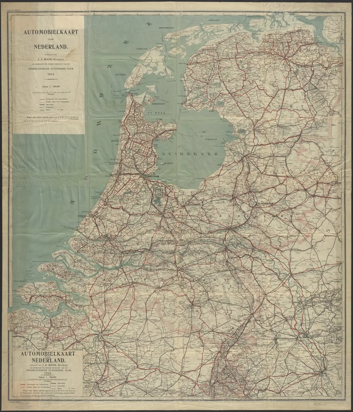
“Where do we turn off?”
The passenger leaned over a map that was really too large for the available space. Part of it rested on their lap; another part reached up against the dashboard. The place name that had just appeared on a road sign was somewhere on that sheet of paper. They just had to find it.
“I think it’s the next exit.”
Travelling with a paper road map meant making the connection yourself between the world outside the car and the lines on the page. There was no blue dot moving along with you. No voice giving a timely warning. And if you took a wrong turning, the map stayed exactly the same.
The journey began at the kitchen table
For an unfamiliar destination, the map often came out before you left home. A map of the Netherlands could still fit on the table, although the fruit bowl sometimes had to move. A holiday in France required more maps or a road atlas.
First you found your destination. Then you traced the roads from home with a finger. Which major towns would you pass? Where would you change motorways? Was the shortest route also the most convenient?
Some travellers wrote a sequence of place names and road numbers on a slip of paper. Others marked the map in pencil. Planning produced a route, but also a first impression of the journey. You could see how far it was, which river you would cross and where the mountains began.
The holiday had not started yet, but in your mind you were already on your way.
A country full of lines and symbols
A road map had to fit a great deal of information onto a limited amount of paper. Colours and line widths distinguished different kinds of roads; the key explained how to read them. Place names sat among rivers, railway lines and borders. More detailed maps added symbols for campsites, sights and viewpoints, among other things.
Regular map users became familiar with this language. You looked at the scale to understand how much distance a few centimetres actually represented.
A map could tempt you, too. There was a village with an unusual name. A road followed the coast. And that detour through the forest looked rather more appealing than the main route.
The map did more than help you reach a destination. It could also give you the idea of going somewhere else.
The passenger became the navigator
With two people in the front seats, a division of labour often developed. The driver watched the traffic; the passenger kept track of the route. It worked well as long as both meant the same thing by “turn right in a moment”.
The map reader had to think ahead. An instruction was little use once the exit was behind the car. At the same time, it could be difficult to keep track of your progress on paper. A village, a bridge or a junction could help you find your position again.
Some people kept north at the top. Others turned the map to match the direction of travel. Both approaches could work, but rotating an unfolded road map halfway round in a small car required patience.
If you were driving alone, you stopped occasionally. In a car park, you checked the map again, memorised the next stretch and put it away.
Folding the map was a skill in itself
A new map came neatly folded inside its cover. After a few journeys, it developed a character of its own.
The creases turned white. Small holes appeared where folds crossed. A corner no longer stayed where it was meant to. Sometimes the very section you needed was folded inside.
Opening it was usually manageable. Returning it to the same neat rectangle was more difficult. The paper suddenly seemed to have a different opinion about the order of the folds.
For the moment, it could go between the seat and the door. Or half folded into the glove compartment, beside a parking disc and a collection of receipts.
A road atlas sat more easily on your lap
Anyone tired of large folding maps could use a road atlas. The maps were printed on pages, making the whole thing easier to handle.
There was a trade-off: sometimes your route stopped halfway through the journey at the edge of a page. A reference pointed to the page where it continued, which was not necessarily the next one.
Your finger followed the road to the edge. Turn the pages. Find the continuation. Carry on.
An atlas made map reading more manageable, but sometimes you had to assemble the bigger picture in your head.
Then came the street atlas
The road map had brought you to Utrecht, Eindhoven or Groningen. Now you still had to find an address in a neighbourhood you did not know.
That was the job of city maps and street atlases. In the Netherlands, such a book was commonly called a stratenboek: literally a “street book”. A separate city map showed one place in detail. A street atlas collected maps of different towns and cities, with indexes for finding individual streets.
Falkplan-Suurland, for example, published a 101-stedenboek van Nederland, an atlas of 101 Dutch towns and cities. The Dutch library catalogue lists an edition from 1985 and a later version from 1991 titled Het stedenboek van Nederland.1
You searched in stages. First the town or city, then the street name in the index. The reference directed you to a map sheet or page and a grid square. A combination such as D4 — an example here — narrowed the search to a small rectangle.
There was the street. Now you just had to work out how to reach it.
Finding a street was not the same as finding a front door
A street atlas solved many problems, but not all of them. You needed to know which side of the city you were entering from and which roads you could use. A one-way street, a closed passage or the wrong bridge could complicate the route.
And finding a long street did not mean the house number you wanted would immediately come into view. Sometimes there was still quite a distance to drive.
When visiting someone, you therefore often received additional directions: left after the church, right at the second junction and park opposite the bakery.
That local explanation complemented the map. A street name was precise, but a distinctive building could be easier to recognise along the way.
Asking someone for directions
If you got stuck, you found somewhere to stop. At a petrol station, a shop or beside a passer-by, you could ask how to continue.
Sometimes the answer came with a finger pointing at the map. Sometimes with a diagram drawn on a scrap of paper. And sometimes with so many landmarks that you were unsure again after the first turning.
Still, a conversation could provide exactly the missing piece. The map showed the roads; a local resident knew which entrance you needed or that the main street had temporarily been dug up.
The new neighbourhood was not in the book
A paper map recorded a situation as it was when its information was compiled. After that, the world continued to change.
Housing estates appeared. A new bypass took traffic away from the old route. Street layouts changed. A map that still seemed perfectly usable could be out of date at a crucial point.
Sometimes you only discovered that on arrival. The address was not in the index, or the road outside no longer matched the line on paper.
Buying a new edition was therefore part of using maps. Even so, an old atlas could remain in the car for years because it was still adequate for most journeys.
From map to screen
Digital route planners first changed the preparation. You entered your starting point and destination, then printed the instructions. Paper still came along for the journey, but much of the route planning had been taken over.
Satnavs and later smartphones changed the journey itself. They could show your position and give fresh directions when you left the planned route.
An unfamiliar address became much easier to reach. The passenger had less searching to do, and the street atlas lost its usual place within easy reach.
Another habit faded with it: taking the time beforehand to look at where you were actually going.
There is still a place for paper
Paper road maps have not disappeared. The ANWB, the Dutch motoring organisation, still sells road maps, including maps of the Netherlands and maps from other publishers.2 They can be useful for planning a trip or as a backup alongside digital navigation.
Their strength remains the overview. A large map lets you see an entire region at once. You can discuss a route, compare alternatives and discover what is nearby without continually panning or zooming.
An old street atlas also has a second life as a record of its time. It shows which neighbourhoods already existed, where the city ended and which roads have since changed.
A worn map sometimes tells a more personal story. A circle around a campsite. A route marked in pencil. A tear at the spot you kept checking during that particular holiday.
You may no longer remember which exit you needed. But that sheet of paper can still bring back exactly what it felt like to be on the road.